explore Colorado physiography
Statewide
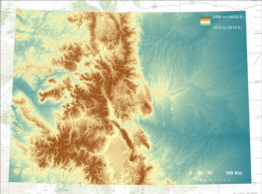
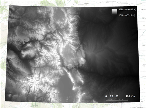
Colorado elevation maps displayed as stretched values along a grayscale and color ramp. Elevations range from 1010 m (3315 ft.) in the northeast section of the state where the Arikaree River flows into Kansas to 4399 m (14433 ft.) at the summit of centrally located Mount Elbert.
 |
|
| Statewide DEM | 2000 x 1486 |
 |
|
| Statewide DEM | 2000 x 1486 |